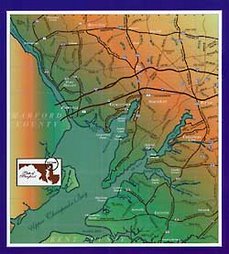
Cecil County was mandated by the state to produce a land use
Tier Map in conformance with their four basic land use parameters according to
SB 236. This state initiative was apparently designed to eventually
displace the locally developed County Comprehensive Plan with a more
centralized State Plan. The County Commissioners at that time could not reach
agreement on a map. The Planning Commission proposed a different map that
would mirror the Comprehensive Plan, but it was ignored and shelved. No map was
forthcoming from the newly elected County Council, and so a map was submitted
administratively by the County Executive to avoid having the state draw our map
for us, as the deadline for submission neared.
The goal of the law (SB 236) was to limit impacts of large
subdivisions on septic systems on our lands and waters in the Chesapeake Bay
watershed. It was supposed to be a straightforward application of
existing zoning, comprehensive plans and sewer service. The Tier Map for Cecil
County does not meet this criteria according to Maryland Department of the
Environment. A Public Hearing will be held on February 19 to discuss their
comments. Our neighboring Harford County has met this standard, with a
Tier map that reflects its Comprehensive Plan. Our Cecil map appears to
be the victim of the political discord that has inflicted our County during
recent years.
I feel strongly that insofar as the tier map reflects the
Comprehensive Plan I accept it. I equally agree that insofar as the map
disagrees with our Comprehensive Plan, I reject it. You can read the
County Comprehensive Plan at: http://www.ccgov.org/uploads/PlanningAndZoning/General/2010ComprehensivePlan.pdf
The County
Comprehensive Plan provides the foundation document for our local land use
policies. It is the basis for our County codes and ordinances for
planning and zoning..
I spent over
two years in a fairly contentious and difficult democratic process to devise a
Comprehensive Plan for Cecil County. A Citizens Committee of 41 people
from all over the County was appointed by our elected commissioners to write
the comprehensive plan. It took two and a half years and over 100
meetings to finalize the product. That plan was then vetted by the Planning
Commission and finally approved by the County Commissioners. The
resulting plan is a compromise, and it is probably not perfect, but in my
opinion, it does represent the consensus of the County as a planning document
expressing what we collectively want our County to be. It is a product of
grass roots democracy involving many dozens of citizens at several layers. It
should not be lightly dismissed by those who believe in participatory
democracy.
Now SB236 has
been passed and signed into law. I believe we are a nation of laws.
The Maryland Department of Planning has commented on our maps, and for purposes
of this discussion, where their direction is in harmony with our local
Comprehensive Plan, then I agree with that direction.
The land use
plan[1]
lists twelve specific goals and objectives, and I think you can safely say that
the broad consensus, almost unanimously agreed, was that we would create
distinct growth areas where we wanted to channel growth and attempt to preserve
areas where growth would be undesirable[2].
The Priority Funding Areas and Enterprise Zones are roughly congruent with the
“growth corridor” bounded by 1-95 and Route 40 and up Elkton/Newark road.
It makes sense
that we’d want to focus our investment and resources in the growth area for
maximum return on our public monies. We still do not have the adequate
infrastructure we need in the growth corridor to attract the economic growth,
and jobs our citizens need.
It makes equal
sense to me that if we disburse our resources outside the designated growth area
it would be wasteful and inefficient. I, for one, would rather see utilities
and services that result in economic growth, rather than dilute our scarce tax
dollars to widen a bridge or build a new school out in the countryside as a
result of unwanted development. Our priority should be building out the growth
area we have, not expanding it further, dissipating our limited resources. The
lack of jobs and opportunity are always among our biggest challenges,
especially in this weak economy.
For me, the
preservation piece of this law is also about preserving a viable agricultural
industry that is a major economic contributor to Cecil County. The county is
approximately 71% rural. I agree with the Comprehensive Plan that rural
character defines so much of our county[3]
and that’s a big reason people like it here. The Plan states, “The County
intends for rural areas to remain rural and for the agricultural and other
natural resources within them to remain viable and economically
productive.” I’m interested in sustaining farming and encouraging farmers
as a matter of economic vitality. Converting productive cropland to "house
farms" destroys an economic resource and replaces it with a demand for
increased public services and expensive infrastructure exactly contrary to
where the comp plan says we want our County to grow.
Our
Comprehensive Plan allows for exceptions, including the villages, the towns,
and their projected growth areas. We have grandfathered existing and already
planned development, and the result is a map of many small exceptions.
Our most recent comp plan also expanded modestly, our growth area especially
south of Elkton and along the east side of Turkey Neck and above
Perryville. I encourage all citizens to read and review the County
Comprehensive Plan. I believe it to be a product which represents the
broad consensus of the citizens of the County. No one will agree with
every word, but most can agree with the overall blueprint of our County’s
future as presented in the Comprehensive Plan. This document should be
the guide for our Tier Map.
Kennard
Wiggins
Elkton
Maryland, 21921
[1] Section 3.1, Goals
and Objectives, page 3-1
[2] Section 2.6 “Cecil County’s
Future, page 2-6
[3] Section 3.5.2 “Rural
Area” page 3-16


No comments:
Post a Comment